Bainbridge Sea-Level Rise Report Just Released
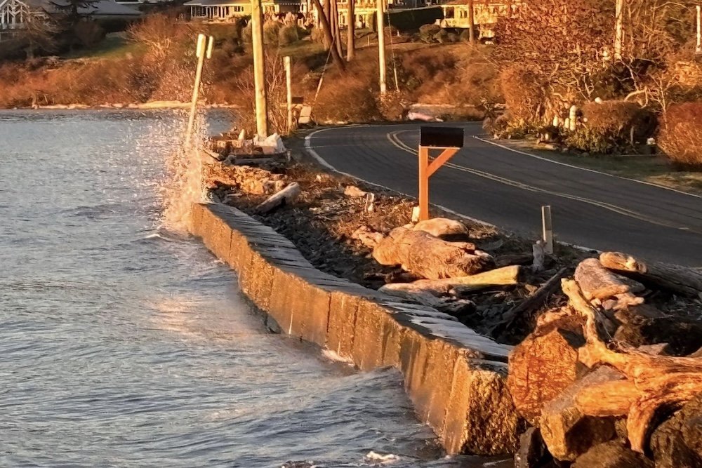
Bainbridge Island–based EcoAdapt recently released their Bainbridge Island Sea Level Rise Project Summary Report 2022-2025. The cover of the report shows Manitou Beach at high tide when the water level is just a few feet below the road surface.
“Bainbridge Island is likely to experience about a foot, and possibly up to a foot and a half, of sea level rise by 2050; by 2100, sea levels are likely to rise more than 2 feet, to possibly more than 5 feet by the end of the century.”
During the winter of 2022–23, EcoAdapt surveyed Islanders about their awareness of and ideas for addressing sea level rise. Four hundred people responded. In addition, EcoAdapt facilitated community conversations about the topic to increase awareness and generate solutions. The nonprofit also generated a resource page on sea-level rise including data viewers, local and regional risk assessments, and resources for homeowners.
In partnership with Hyla School, EcoAdapt created a graphic for the overhead walkway at the ferry terminal and an educational website including a sea-level rise prediction map. They are working on a second graphic for the Bremerton ferry terminal that is sp[onsored by the Kitsap Community Foundation.
A grant from the Rotary Club will support a partnership with the Bainbridge Island Metro Parks and Recreation District to create a sea-level rise sculpture at Fay Bainbridge Park.
EcoAdapt is a nonprofit dedicated to supporting governments, organizations, and individuals in adapting to climate change.
The local nonprofit spent four years on the sea-level rise report, supported by the Bainbridge Community Foundation. BCF has funded EcoAdapt on this project for another year, which will include the 2026 Bainbridge Island Environmental Conference, which will focus on sea level rise.
Featured image of Manitou Beach at high tide is by Deb Rudnick.